Record Snowfall in North Central Washington
North Central Washington continues to dig out from Thursday morning's major snowstorm.
National Weather Service Meteorologist Marilyn Lohmann said actual snowfall well exceeded what they were predicting Wednesday, with the storm riding a warm conveyor belt of moist air from the Pacific Ocean into cold Eastern Washington. Many places on the east side of the state haven't seen temperatures above freezing since Christmas.
"Normally the Cascades are a pretty good barrier, but this one was so strong that it just over-topped the Cascades and came on in." explained Lohmann, "When you have that cold air in place it's a very efficient snow producer.
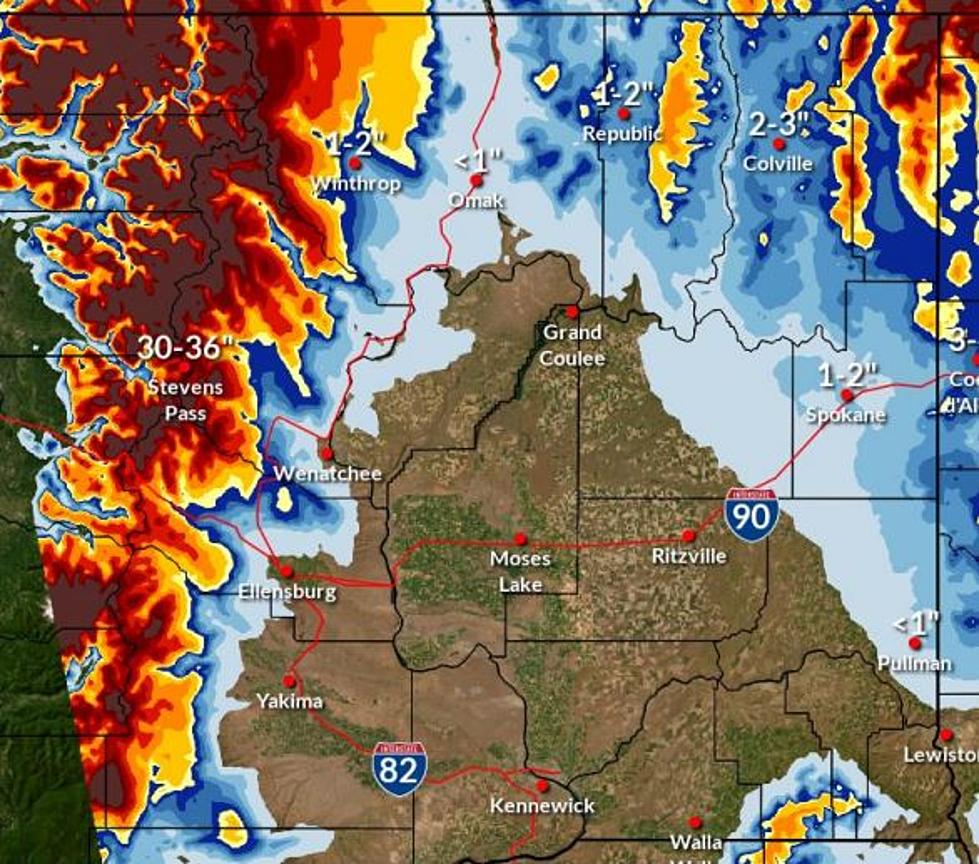
Wenatchee likely broke an all-time record for snowfall within a 24-hour period. Between 20-25 inches fell Wednesday night into Thursday morning. The previous record in Wenatchee was 17.7 inches set in 1971.
Other locations also were inundated with snow. Leavenworth reportedly received 31 inches, Ellensburg got 20 inches, Chelan 16, Quincy 10 inches, and Moses Lake and Ephrata both saw almost 7 inches.
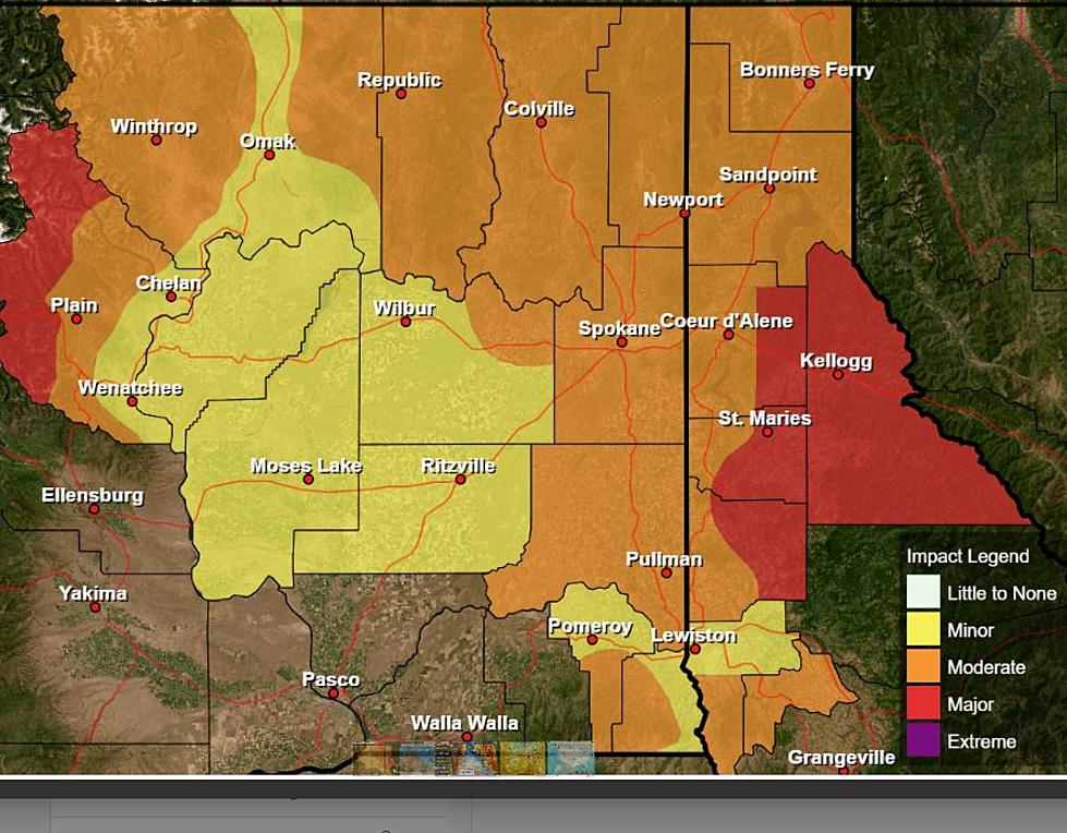
With most of the snow now out of the atmosphere and in our backyards, residents need to also prepare for new weather patterns over the next few days.
The National Weather Service issued a High Wind Warning for Douglas and Grant Counties from 10:00 am to 7:00 pm Friday, with gusts up to 55 mph expected. Wenatchee can expect gusts of up to 40 mph. The winds could also causing blowing snow over roadways in some areas.
Lohmann added that temperatures should rise Friday, with would-be snow turning instead to rain, freezing rain and sleet in places. Conditions Saturday through early next week are forecast to be cold and dry, with freezing fog potentially at night.
More From NewsRadio 560 KPQ