High Winds, Blowing Dust and Snow Bring Danger Sunday
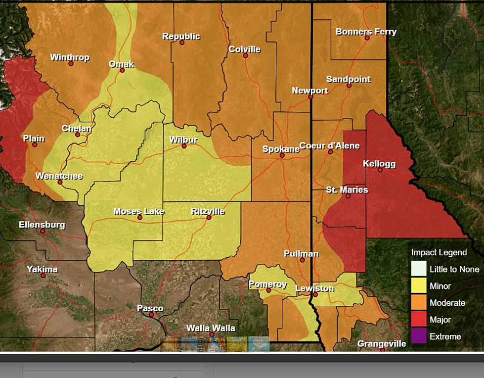
High winds and in some places blowing snow are expected to impact most of Eastern Washington Sunday into Monday morning.
According to the National Weather Service office in Spokane, southwest winds are expected to increase from the morning on Sunday. The peak of the wind event is estimated to be Sunday afternoon to the evening, when gusts could get up to 60-65 miles per hour in some places. Gusty winds are then expected throughout Sunday night, decreasing after sunrise Monday morning.
The winds are expected to be especially impactful in the Columbia Basin. Blowing dust is possible in places and could make routes like I-90, SR 26, SR 17 and others difficult to travel on. The dust could cause near zero visibility across the roadway, especially when it comes to high profile vehicles.
Downed trees and power poles are also a possibility and could cause property damage, power outages or brushfires. Any brushfire sparked during the wind event has the potential to grow quickly due to the high winds and last year's dead, dry grass.
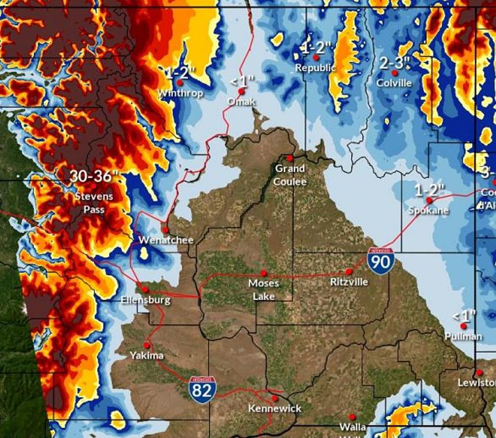
A winter weather advisory is also in the forecast for the Cascade Mountains and Steven's Pass, with moderate to heavy snow likely Sunday afternoon through early Monday morning. Highway 2 between Cole's Corner and Steven's Pass could have some of the biggest impacts. Snow accumulations for the area could be up to a foot and gusting winds could cause blowing snow, making travel difficult.
More From NewsRadio 560 KPQ