Rare Atmospheric Conditions to Bring Wet Weather, Winter Storm Advisory to NCW
The National Weather service is warning Central Washington residents of winter weather in the higher elevations and very wet weather for the rest of us.
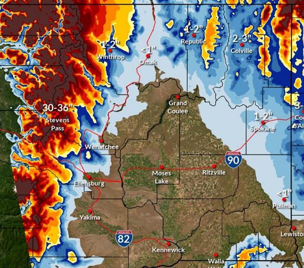
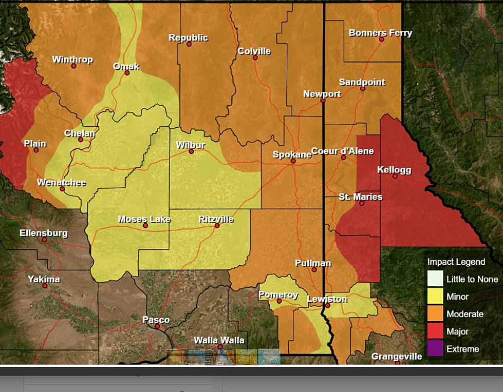
Areas like the Wenatchee Valley and the Columbia Basin could see a half inch or more of rain this weekend. A weak system will move through the area Saturday bringing sporadic showers. The much more powerful system comes Sunday, part of what is called an 'atmospheric river.' Rain should be expected throughout NCW from Sunday morning through early Monday morning.
Meteorologist Jonathan Fox said the combination of an 'atmospheric river' moving through the area and a 'bomb cyclone' in the Northeast Pacific will flip the normally westerly wind direction and temporarily give our area a taste of the west side's usual climate.
"So not only do you get the rainfall from the system, but we're going to see some pretty decent winds as well." detailed Fox, "Right now we have wind gust forecasts of about 30-35 mph, with those windiest conditions probably over the Waterville Plateau and perhaps extending southward into the Columbia Basin."
Blewett, Snoqualmie and Stevens Pass should see heavy rains at times but will likely be too warm for any snow to stick.
A Winter Weather Advisory has been put in place for Washington Pass on Highway 20, which could see seven to eight inches of snow. It is unlikely SR 20/North Cascades Highway will close for the season even if it experiences heavy snowfall from this storm.
More From NewsRadio 560 KPQ