New Evacuation Notices Issued For Lower Sugarloaf Fire, Remains 11% Contained
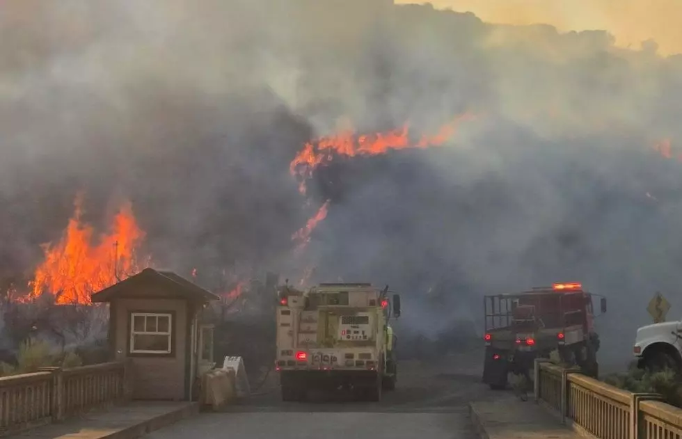
Less than 24 hours after crews assigned to the Lower Sugarloaf Fire in Chelan County announced they had finally achieved some level of containment over the blaze, emergency officials have elevated evacuation notices for some locations surrounding the blaze and also issued new ones.
The fire, which was sparked by a lightning strike on Aug. 31 and is centered 12 miles east of Leavenworth on the Wenatchee River Ranger District in the Okanogan-Wenatchee National Forest, is now listed at 18,360 acres and remains at 11% containment.
On Tuesday, the Chelan County Sheriff's Office issued a Level 2 "Be Ready" evacuation notice for the area above Merry Canyon "on Chumstick north to Fish Pond Lane," including all of Little Chumstick, as well as in the Entiat River Valley "downriver to Dinkleman Canyon Road."

Sheriff's officials also issued a Level 1 Fire Advisory for west side of Entiat River Road, from Roaring Creek Road up to and including Mills Canyon Road, as well as from Fish Pond Lane north (east side of Chiwawa Loop Rd up to USFS 6101), including Wending Lane, Clear BTM, and Lower Chiwawa River Road.
A Level 2 notice which had been in place for all homes below Merry Canyon and Second Creek Road has also been reduced to a Level 1 Fire Advisory.
All other evacuation notices and advisories attached to the Lower Sugarcreek Fire are as follows:
Level 2
- All of Ardenvoir, including Mad River Road
- The west side of the Entiat River from 8213 Entiat River Road to 10679 Entiat River Road including Sunshine Lane and Sines Lane
- Upper Chumstick Highway: Area includes Merry Canyon, Second Creek, Dry Creek, and Little Chumstick
- Moon Canyon
- Entiat River road from and including Roaring Creek Road to 10730 Entiat River Road, including Mud Creek Road, Steliko and the lower portion of Crum Canyon
Level 1
- All of Fish Pond Lane
- The east side of Chumstick Highway from Eagle Creek to Little Chumstick, including spur roads and driveways
- Deep Creek Road
- Nahahum Canyon Road, including Indian Rock Lane on up
Olalla Canyon Road at milepost 1 and up - Hay Canyon Road, from the end of pavement and up
- Derby Canyon Road, from No. 9088 and up
- Both sides of Entiat River Road, from Roaring Creek to the end of Entiat River Road
On Monday, the fire was most active on its eastern and northwestern flanks due to shifting winds, dry conditions, and steep slopes that encouraged the flames to spread.
Firefighters remained busy in the vicinity of Dinkelman Ridge, Roaring Creek, and Roaring Ridge conducting burnout operations, building new fire lines, and bolstering extant lines.
Hose lays were also established on the blaze's western edge, where helicopters and fixed-wing aircraft also conducted water drops near Moe Ridge.
On Tuesday, crews are scheduled to continue structure protection efforts on the fire's northeastern perimeter near Gold Ridge, and remain active performing both containment and suppression efforts throughout the entire fire zone.
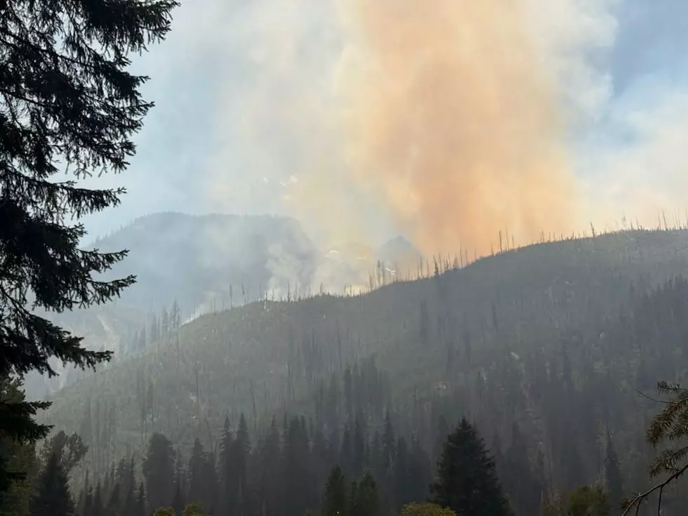
Smoke from the blaze continues to impact numerous communities in the region, and has remained particularly heavy in and around the towns of Entiat and Leavenworth to start the week.
There are currently 1,086 personnel assigned to the Lower Sugarloaf Fire, along with 79 engines; 21 water tenders; 8 dozers; and 7 helicopters.
There have been no reports of any structures being damaged or destroyed by the blaze thus far, and no injuries have been reported.
10 Tips to Prevent Wildfires from the US Department of Interior
Gallery Credit: ASHLEY SOLLARS
More From NewsRadio 560 KPQ